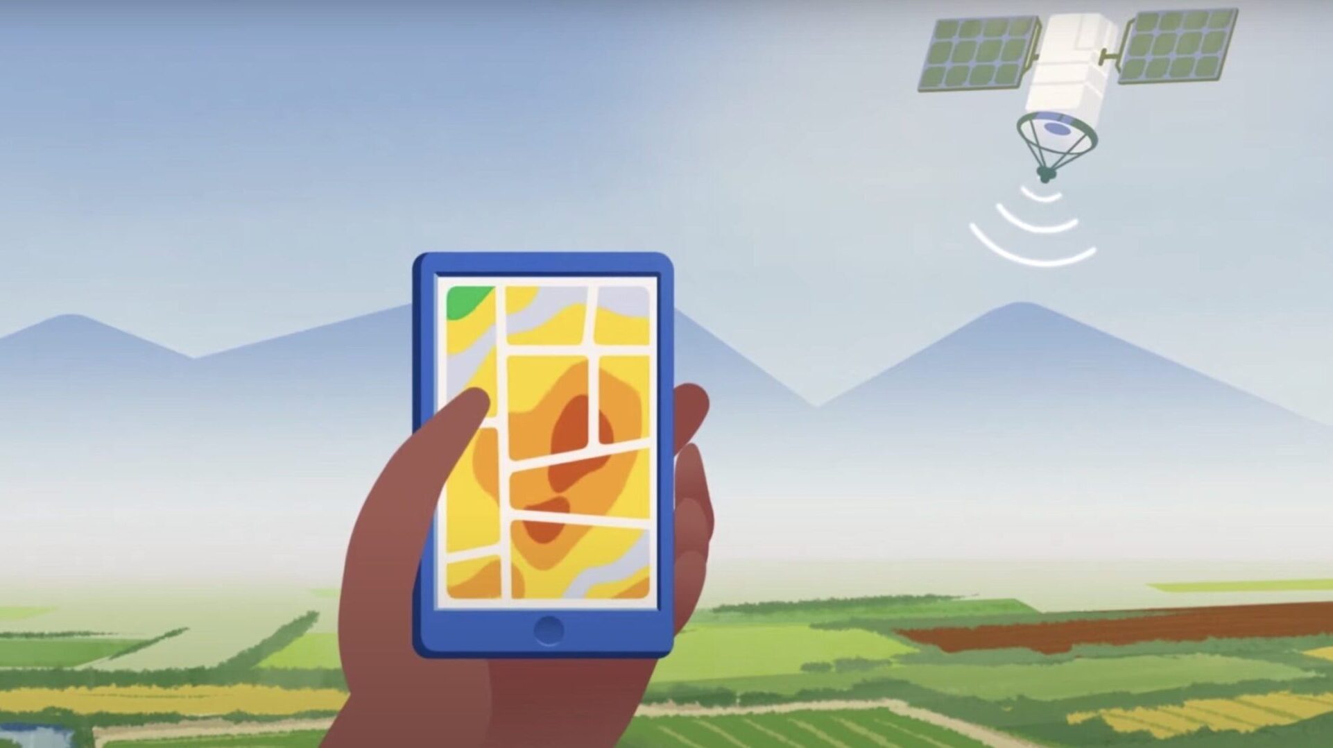
The ability to monitor crop progress and spot problems in the field before symptoms are apparent is crucial for a successful harvest. Exciting advancements in technology allow us to capture images of farms around the world with the aid of satellites, thus making monitoring simple and affordable. The most popular vegetation index that is being used by farmers is NDVI, it is an indicator of the health of the plant based on a reflection of different light waves.
NDVI is a remote sensing method for estimating crop health and biomass. The NDVI index measures the difference between visible and near-infrared reflectance of the vegetation. Crop reflectance depends on leaf area, chlorophyll content, age of leaves, canopy density, and soil type. NDVI is often used with satellite imagery, which provides high-resolution images from space. The use of satellites has helped to make NDVI more accessible to farmers all over the world because it is accessible to anyone with an internet connection. The use of NDVI for crop health monitoring has been around for decades, but it has only recently gained popularity due to the use of satellites and high-resolution aerial photography that provide frequent revisits. It provides an accurate estimate of plant biomass and leaf area index (LAI) without needing any ground data collection or manual interpretation.
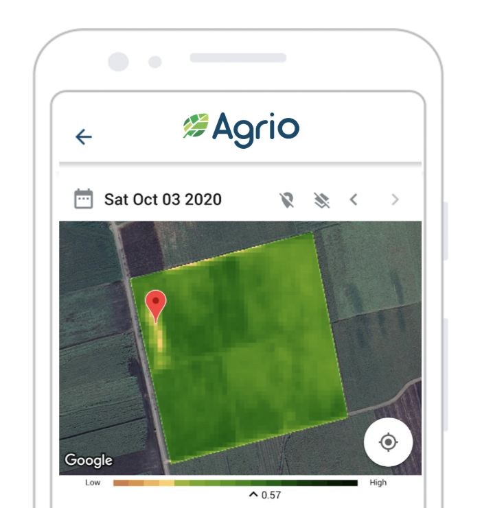
Farmers that are using Agrio can monitor the NDVI index of their fields in a very simple way. All that is needed is to define the field location by drawing a polygon that represents the field boundary. Once this is done we are kicking in to do constant monitoring for you, and notify you when a new scan is available. We expect a scan to be available every few days (in some packages we offer daily revisits), but when the sky is cloudy, and a clear shot of the field is not possible we need to wait for the next time that the satellite is passing above your field. Our algorithms identify the clouds in the sky automatically and we present filtered images that are clean from artifacts.
Agrio users can expect to receive the following images:
We do the image analysis and alert you when we find anomalies. More detailed case studies can be found in the following links: monitoring apple orchards, and monitoring guava orchards.
To give you some intuition on the process let’s refer to the figure above. Regions in which the vegetation is lower compared to other parts in the field might indicate that there is a problem, scouting might be needed in these field regions to further investigate the cause. Use the Agrio smartphone application to upload images of the symptoms you find during your tour. It will help us give a more precise recommendation and improve our capabilities to identify the exact problems directly from the satellite images as we go along.
Moreover, the NDVI index allows us to estimate if the crop is developing in a good phase. If the index is low in the middle of the season, there is probably a problem requiring investigation, like a nutrient deficiency.
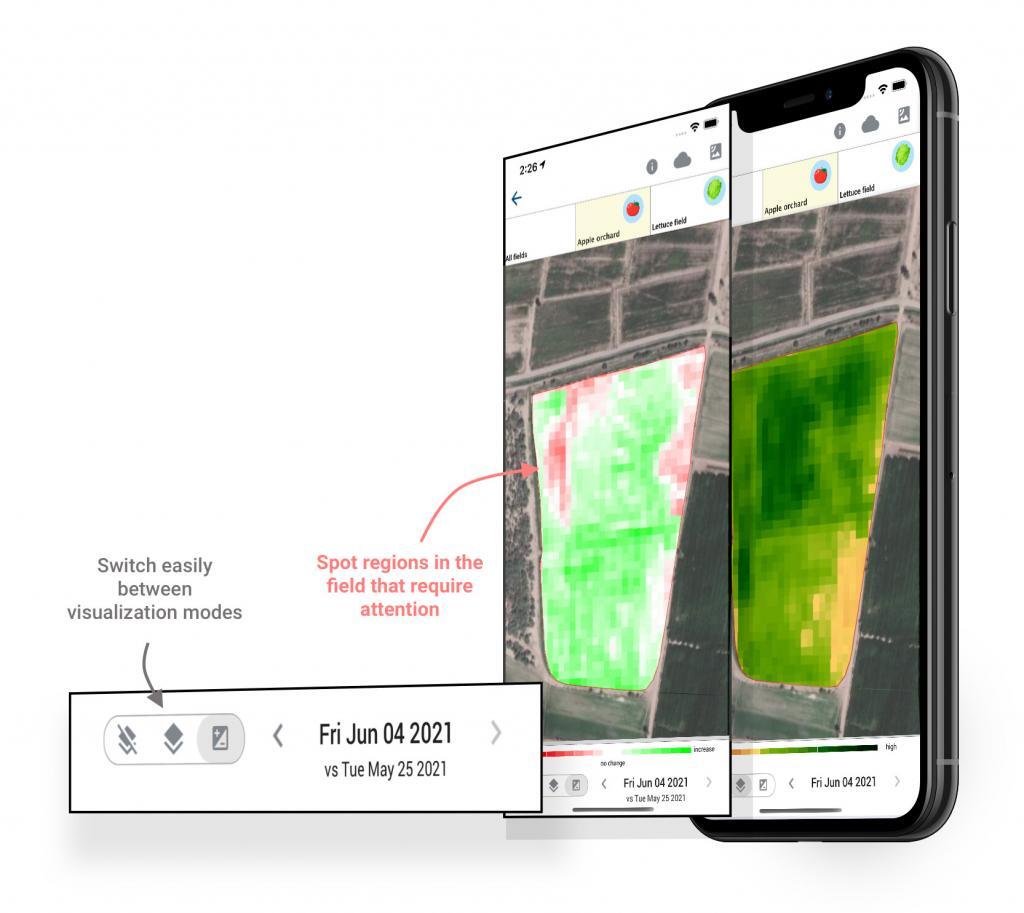
Wondering how your last field intervention affected the plants? Did you manage to improve the health of the plants? Do the leaf area and chlorophyll concentration show improvement? You can monitor such changes by selecting the « compare » tab. We compare your subsequent satellite scans to show you the change in a 3-5 days resolution.
We save you time by optimizing your scouting routes! We are your eyes in the sky.
Take a big leap forward in your farming practices by engaging with the Agrio remote sensing technology. We are looking forward to helping you with that.
In the meantime, as always, we wish you an abundant harvest.