How to monitor crop health using satellites is no longer a question reserved for research institutions and large corporations. Today, farmers can track crop development, detect stress early, and understand field variability using satellite imagery that is both affordable and easy to access. Monitoring agricultural fields, tracking growth, and spotting problems before visible symptoms appear is crucial for a successful harvest.
Quick answer: Crop health can be monitored using satellite scans that highlight plant vigor, uniformity and early stress zones. Agrio’s detection models are trained on millions of real field images with verified problems, allowing farmers to identify nutrition, irrigation and disease issues before symptoms become visible.
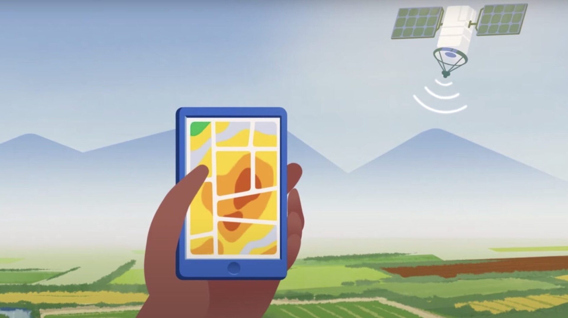
Modern satellite constellations now capture frequent, high-resolution images of farmland worldwide, allowing growers to follow crop performance continuously. The most widely used vegetation index for this purpose is the Normalized Difference Vegetation Index (NDVI), a measure derived from reflected light that correlates closely with plant vigor.
NDVI is a remote sensing method used to estimate crop health and biomass. It measures the contrast between visible and near-infrared reflectance, which is influenced by chlorophyll content, leaf area, canopy density, plant age, and even soil conditions. For decades, NDVI was mainly used by research institutions, but frequent satellite revisits and improved imagery have made it practical for everyday farm management.
By using satellite imagery, growers can now monitor plant development, evaluate uniformity across their fields, and identify stress zones that may indicate irrigation issues, nutrient deficiencies, disease pressure, or compaction, often before symptoms become visible from the ground.
Agrio’s satellite anomaly detection models are trained on millions of real-world field images uploaded by growers, giving the system unique ground-truth data that links satellite signals to actual crop problems.
Farmers using Agrio can monitor their fields and track NDVI in a simple way. After drawing the field boundary once, Agrio begins automatic monitoring and notifies you whenever a new satellite scan is available. Depending on the satellite package, revisits are available every few days, and even daily in some regions. Cloud detection and filtering are handled automatically, so only usable images are presented.
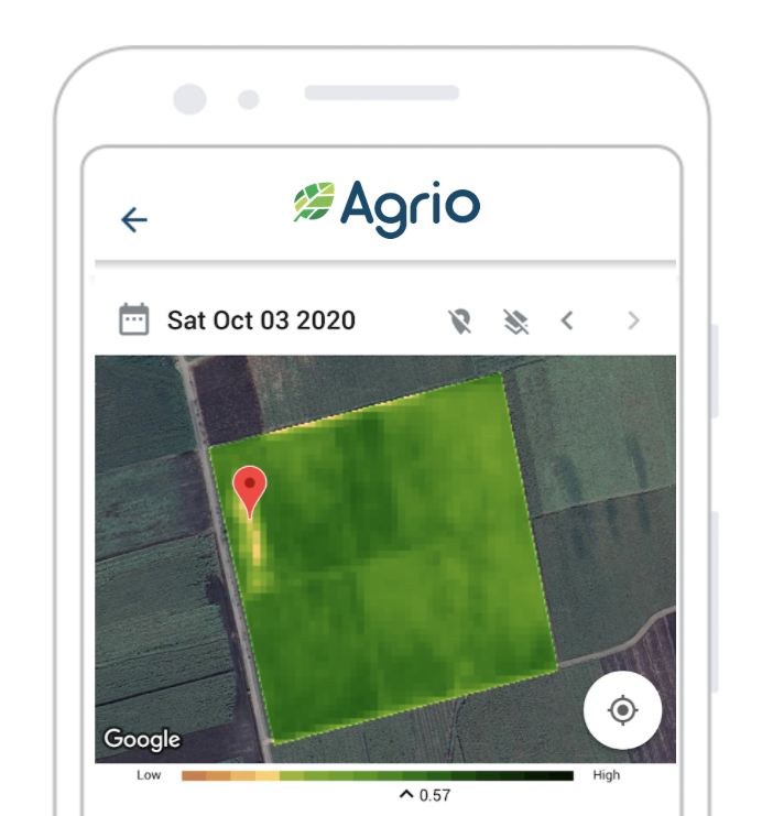
Agrio users can expect to receive the following types of satellite-derived imagery:
Our system analyzes each scan and alerts you when anomalies are detected. These alerts highlight zones where vegetation behaves differently from the rest of the field, helping you focus scouting efforts exactly where they matter most. You can read real-world experiences from growers using satellite monitoring in our case study on apple orchards.
In the map above, vegetation levels are represented by color. Brown indicates weak or sparse growth, while dark green represents dense, healthy vegetation. Areas that appear yellow or light green relative to the rest of the field often deserve closer inspection, as they may signal early stress.
During scouting, you can upload photos directly through the Agrio mobile app. Harvie, Agrio’s in-app agronomy assistant, uses these images together with satellite data to help refine recommendations and improve field-level diagnosis over time.
NDVI trends also allow you to evaluate crop development across the season. If vegetation levels remain low during periods when growth should accelerate, this can point to nutrition, irrigation, or root-zone issues that may require intervention.
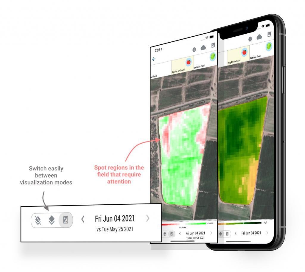
Want to see whether your last field intervention actually made a difference? Using the “Compare” view, Agrio overlays consecutive satellite scans so you can track changes in biomass, canopy development, and chlorophyll levels over time.
Agrio provides access to both Sentinel and PlanetScope satellite imagery. Sentinel offers 10-meter resolution with revisits every 3–5 days, while PlanetScope provides 3-meter resolution with daily coverage. Combining these sources allows for more reliable monitoring even in cloudy conditions and enables closer tracking of subtle field changes.
We save you time by optimizing your scouting routes. Agrio highlights the areas that need attention — so you spend less time searching and more time solving real problems.
Take a step forward in your field management by using Agrio’s satellite-based crop monitoring tools. We look forward to helping you monitor, understand, and improve your crops.
As always, we wish you an abundant harvest.